
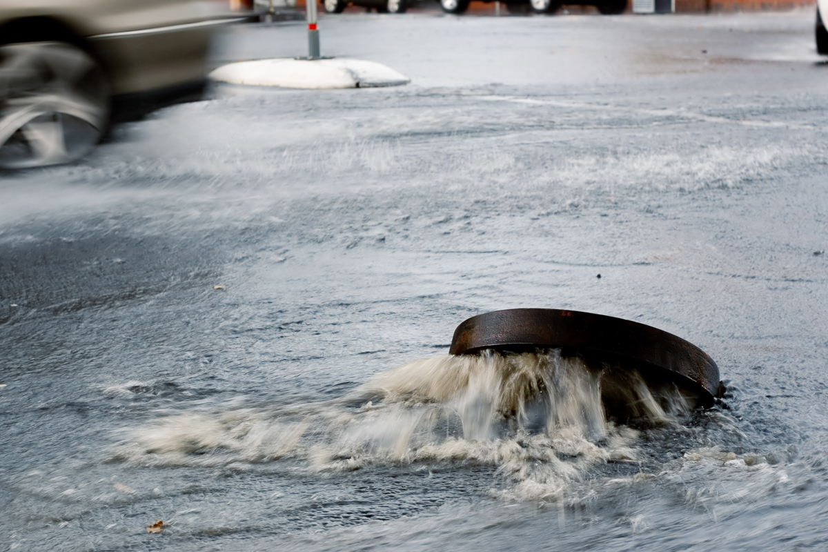
Managing future flood risks in dynamic weather environments requires forward-thinking technology. Engineers often rely on NOAA’s Atlas 14, which provides rainfall intensity-duration-frequency (IDF) curves to guide designs like pipe sizes or bridge heights. However, Atlas 14 assumes rainfall patterns don’t change and ignores recent trends. While the nation awaits Atlas 15, states like North Carolina are filling the gap with new tools.
This live virtual program will discuss one of these new tools, RaInDROP (Rainfall Intensity, Duration, and Return for Observations and Projections). RaInDROP blends engineering expertise with future climate insights. Tools like RaInDROP reveal changing precipitation extremes, while stress-testing systems against historic storms and using atmospheric models to provide insights to how future versions of those storms might evolve. Participants will hear examples of how municipalities and state agencies are already using RaInDROP data and atmospheric models to strengthen long-term flood resilience.
After completing this course participants will be able to:
- Explain rainfall intensity, duration, and frequency of rainfall events.
- Describe methods and datasets that support RaInDROP.
- Provide examples of how RaInDROP and atmospheric model experiments are being used to inform long-term flood resilience.
Links/Handouts
Speaker
Jared Bowden
Interim Director
State Climate Office of North Carolina
Moderator
Alicia Lanier
Stormwater Project Manager – Special Projects
City of Fayetteville, North Carolina
Hosted by the Water Resources Committee.

Claim CEUs
Submit this form to claim CEUs.
Related Resources

Proficiency Levels
Introductory
Focuses on a general or broad overview of the topic, awareness of basic factual recall. Limited experience of the subject matter is necessary to understand content areas.
Applied
Focuses on practical implementation of technical steps or strategies, some prior knowledge and experience of the topic is necessary.
Advanced
Mastery of basic concepts associated with an area has been obtained. Focuses on understanding nuances, advanced concepts, and intricacies with implementation within knowledge area. Strong understanding of how the concept impacts other factors or areas of operations.
Program Types
CLL
Click, Listen & Learn (CLL) are interactive educational webinars. Each program is led by top experts in the field who share new ideas, methods, and technologies in a fast-paced two-hour time frame. These programs are available free to APWA members. CLL programs are eligible for continuing education units (CEUs).
Primer
Primers are used to educate policymakers about public works roles and responsibilities in public rights of way, the impact of federal workforce development policies on the industry and workforce, and the importance of resilient infrastructure.
Public Works Radio Podcast
Public Works Radio is the official podcast of the American Public Works Association (APWA), bringing the stories behind our communities to life. This podcast shines a spotlight on the people and projects that keep our cities running—humanizing the work and the professionals who make it happen. Each episode dives into a wide range of topics designed to educate and inspire, making public works more visible to everyone.
PWX
PWX session recordings cover a wide variety of topics, including integrating modes of transportation, traffic and transit, construction management, emergency management, engineering and technology, fleet and facilities, management, parks and grounds, snow and ice control, and stormwater/flood control, as well as solid waste, roads and bridges and water/wastewater. PWX sessions are eligible for continuing education units (CEUs).
Reporter Articles
APWA Reporter articles are written by public works practitioners on subjects such as solid waste management, water resources, municipal engineering, transportation, equipment services, buildings and grounds, snow removal, and other public works-related topics.
Snow
The Snow Conference session recordings feature public works professionals sharing the latest best practices in managing winter/snow operations more successfully, taking advantage of emerging technologies, understanding and preparing for the challenges ahead, and providing better service to their communities. Snow sessions are eligible for continuing education units (CEUs).
Tech Boxes
A tech box is a PDF take-away that provides information in lists, steps, or defined areas specifically focused on trending technologies.
Virtual Program
Virtual programs are live, interactive educational programs led by top experts in the field who provide timely information or address trending topics within an area. Programs often conclude with an open forum for Q&A.