
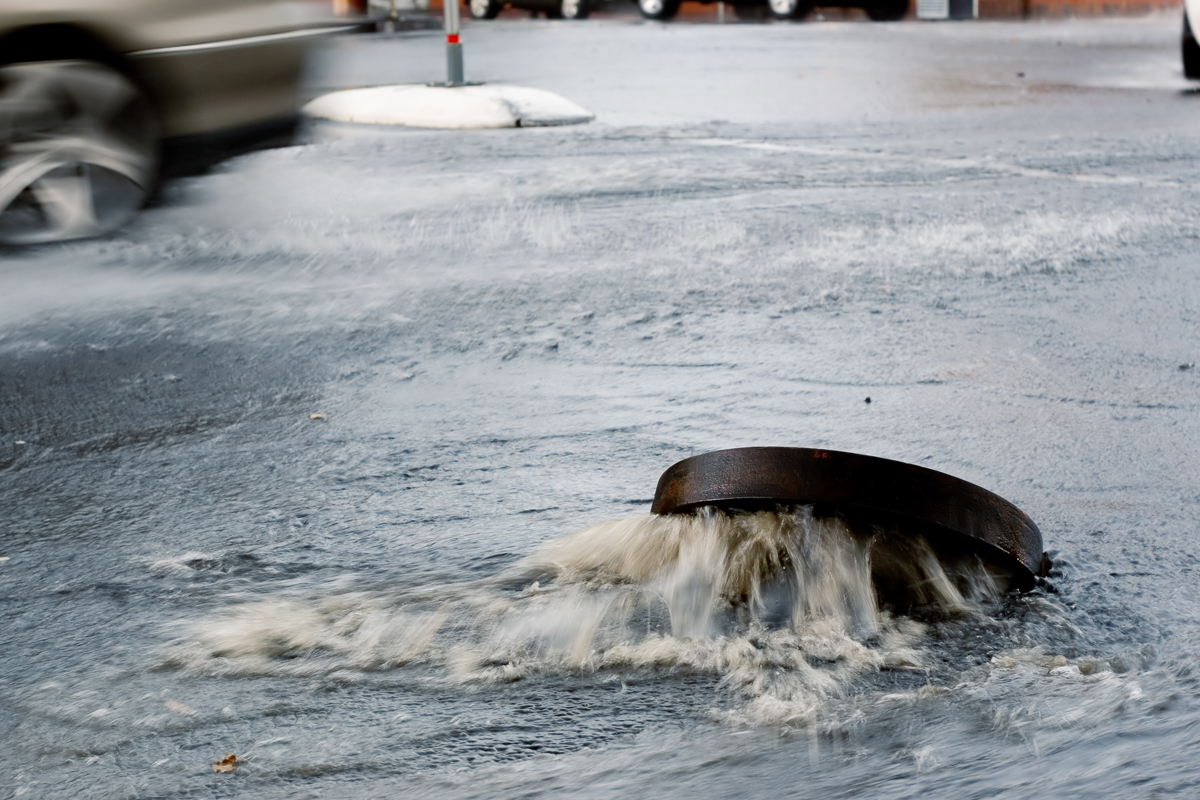
The Tulare County Resource Management Agency (“RMA”) has installed several IoT water level sensors throughout the county to assist in monitoring stream levels and areas of concern for flooding, the use of which has proved invaluable to flood control operations in the county. The devices use a sonic sensor to determine stream height within 1/100th of a foot, are battery powered with a solar option, and communicate data to the cloud via cellular networks. Alarms and notifications may be set based on data from individual sensors for specific water levels or specific rates of increase in the water level, which may be targeted towards first responders or the public to warn residents of impending road closures or dangerous conditions. This presentation outlines two case studies and one proposed application of the devices. The first case study involves monitoring a bridge where current operations require closing the bridge and removing the guardrails during high flows. The second case study describes the use of two sensors during a flooding event along the Kings River in Tulare County. During this event, various federal, state, and local agencies monitored the data from the devices in conjunction with dam releases and observations to limit the impact of flooding. The proposed application places the devices at various storm water pump stations through the county, which will be used to prioritize resources during emergencies.
Proficiency Level
Applied
Learning Objectives
- Evaluate the use of IoT flood level sensors in gathering and distributing water level data for use in monitoring water resources and flooding events
- Implement new technologies that are cost effective to improve efficiency and reduce risk while managing limited resources during flooding events
- Develop emergency warning systems using data from flood level sensors for use in public messaging and decision making by first responders
Contributor/Source
Ross Miller;Randy Weatherspoon
Claim CEUs
Submit this form to claim CEUs.
Related Resources

Proficiency Levels
Introductory
Focuses on a general or broad overview of the topic, awareness of basic factual recall. Limited experience of the subject matter is necessary to understand content areas.
Applied
Focuses on practical implementation of technical steps or strategies, some prior knowledge and experience of the topic is necessary.
Advanced
Mastery of basic concepts associated with an area has been obtained. Focuses on understanding nuances, advanced concepts, and intricacies with implementation within knowledge area. Strong understanding of how the concept impacts other factors or areas of operations.
Program Types
CLL
Click, Listen & Learn (CLL) are interactive educational webinars. Each program is led by top experts in the field who share new ideas, methods, and technologies in a fast-paced two-hour time frame. These programs are available free to APWA members. CLL programs are eligible for continuing education units (CEUs).
Primer
Primers are used to educate policymakers about public works roles and responsibilities in public rights of way, the impact of federal workforce development policies on the industry and workforce, and the importance of resilient infrastructure.
Public Works Radio Podcast
Public Works Radio is the official podcast of the American Public Works Association (APWA), bringing the stories behind our communities to life. This podcast shines a spotlight on the people and projects that keep our cities running—humanizing the work and the professionals who make it happen. Each episode dives into a wide range of topics designed to educate and inspire, making public works more visible to everyone.
PWX
PWX session recordings cover a wide variety of topics, including integrating modes of transportation, traffic and transit, construction management, emergency management, engineering and technology, fleet and facilities, management, parks and grounds, snow and ice control, and stormwater/flood control, as well as solid waste, roads and bridges and water/wastewater. PWX sessions are eligible for continuing education units (CEUs).
Reporter Articles
APWA Reporter articles are written by public works practitioners on subjects such as solid waste management, water resources, municipal engineering, transportation, equipment services, buildings and grounds, snow removal, and other public works-related topics.
Snow
The Snow Conference session recordings feature public works professionals sharing the latest best practices in managing winter/snow operations more successfully, taking advantage of emerging technologies, understanding and preparing for the challenges ahead, and providing better service to their communities. Snow sessions are eligible for continuing education units (CEUs).
Tech Boxes
A tech box is a PDF take-away that provides information in lists, steps, or defined areas specifically focused on trending technologies.
Virtual Program
Virtual programs are live, interactive educational programs led by top experts in the field who provide timely information or address trending topics within an area. Programs often conclude with an open forum for Q&A.