
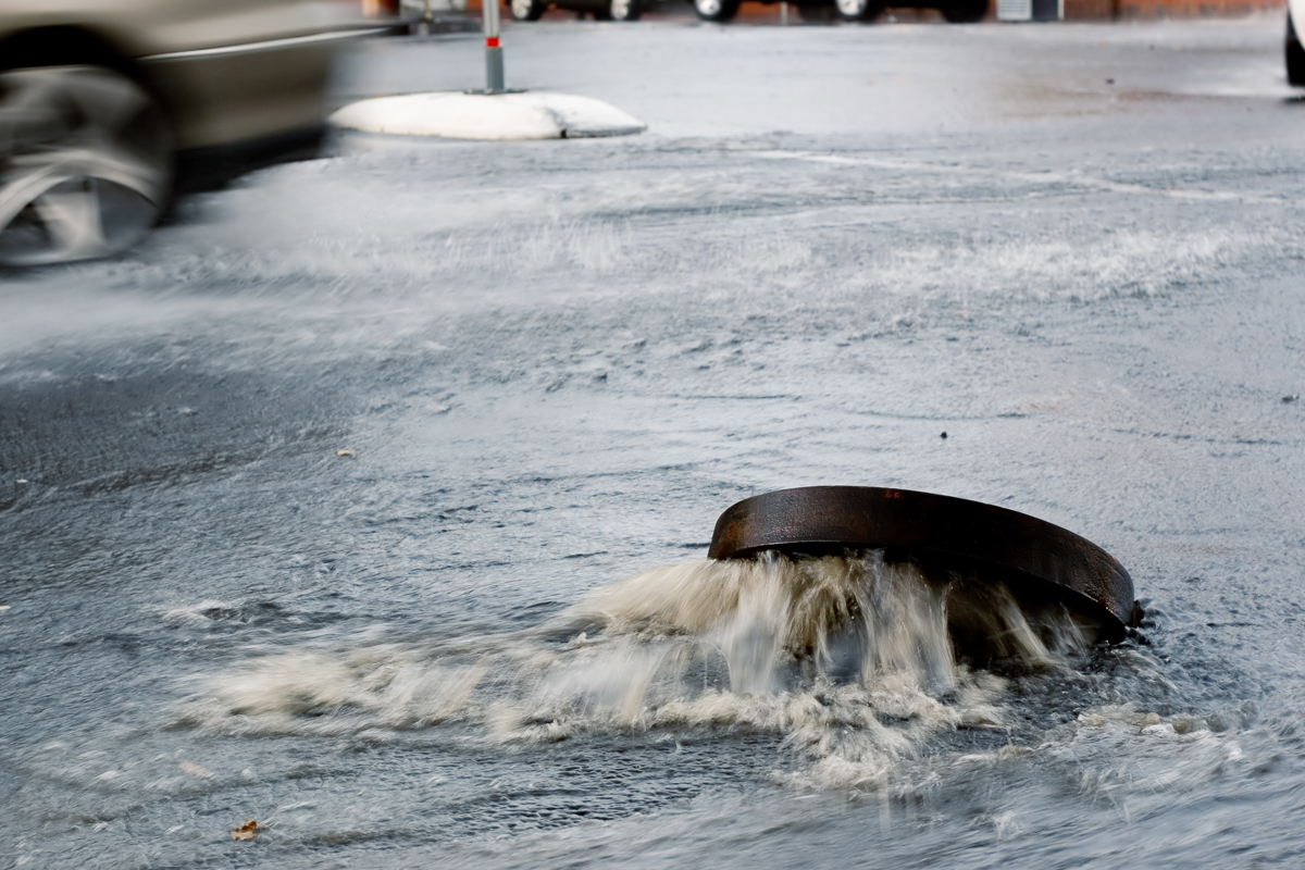
Cobb County Water System’s Stormwater Management Division (SWM) inspects and monitors stormwater outfalls in fulfillment of the Illicit Discharge Detection and Elimination Plan (IDDE) with the goal of preventing stormwater pollution. We have inventoried and mapped over 13,000 stormwater outfall features in our enterprise GIS system. To meet requirements for our Municipal Storm Sewage Systems (MS4) Permit with the US Environmental Protection Agency, the total number of outfalls must be inspected each five-year period. Using ESRI Field Maps and Workforce this year, we have streamlined the inspection process from paper maps and emails to a fully digital workflow for staff.
This has allowed us to meet our annual stormwater inspection requirements more effectively for our MS4 permit provided by the state of Georgia. In addition, it enables our personnel to be successful and has increased accuracy with real-time data inspections and reference to other county digital data in the field.
Learning Objectives:
- Use GIS (ESRI) maps and mobile applications to streamline workflows for field staff doing stormwater inspections.
- Recognize how to convert reporting requirement paper forms into real-time digital data collection methods for staff.
- Provide guidance to their teams on how to increase accuracy and total inspections completed by using digital maps and GIS apps.
Proficiency Level: Applied
Speakers:
Jennifer Lana
Technology Services Manager – GIS
Cobb County Government
Adam Sukenick
Environmental Compliance Supervisor
Cobb County Government Water System
Kade Chapman
GIS Specialist
Cobb County Water System
Claim CEUs
Submit this form to claim CEUs.
Related Resources

Proficiency Levels
Introductory
Focuses on a general or broad overview of the topic, awareness of basic factual recall. Limited experience of the subject matter is necessary to understand content areas.
Applied
Focuses on practical implementation of technical steps or strategies, some prior knowledge and experience of the topic is necessary.
Advanced
Mastery of basic concepts associated with an area has been obtained. Focuses on understanding nuances, advanced concepts, and intricacies with implementation within knowledge area. Strong understanding of how the concept impacts other factors or areas of operations.
Program Types
CLL
Click, Listen & Learn (CLL) are interactive educational webinars. Each program is led by top experts in the field who share new ideas, methods, and technologies in a fast-paced two-hour time frame. These programs are available free to APWA members. CLL programs are eligible for continuing education units (CEUs).
Primer
Primers are used to educate policymakers about public works roles and responsibilities in public rights of way, the impact of federal workforce development policies on the industry and workforce, and the importance of resilient infrastructure.
Public Works Radio Podcast
Public Works Radio is the official podcast of the American Public Works Association (APWA), bringing the stories behind our communities to life. This podcast shines a spotlight on the people and projects that keep our cities running—humanizing the work and the professionals who make it happen. Each episode dives into a wide range of topics designed to educate and inspire, making public works more visible to everyone.
PWX
PWX session recordings cover a wide variety of topics, including integrating modes of transportation, traffic and transit, construction management, emergency management, engineering and technology, fleet and facilities, management, parks and grounds, snow and ice control, and stormwater/flood control, as well as solid waste, roads and bridges and water/wastewater. PWX sessions are eligible for continuing education units (CEUs).
Reporter Articles
APWA Reporter articles are written by public works practitioners on subjects such as solid waste management, water resources, municipal engineering, transportation, equipment services, buildings and grounds, snow removal, and other public works-related topics.
Snow
The Snow Conference session recordings feature public works professionals sharing the latest best practices in managing winter/snow operations more successfully, taking advantage of emerging technologies, understanding and preparing for the challenges ahead, and providing better service to their communities. Snow sessions are eligible for continuing education units (CEUs).
Tech Boxes
A tech box is a PDF take-away that provides information in lists, steps, or defined areas specifically focused on trending technologies.
Virtual Program
Virtual programs are live, interactive educational programs led by top experts in the field who provide timely information or address trending topics within an area. Programs often conclude with an open forum for Q&A.