
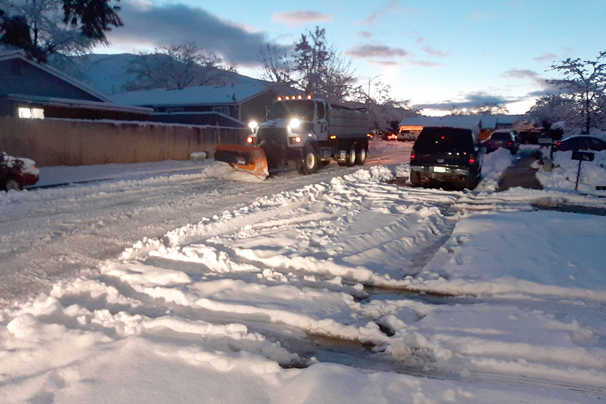
The City of Syracuse consistently sees around 10 feet of snow annually. Although snow can make normal operations more difficult, the City has an experienced and efficient workforce who regularly clears snow to avoid disruption of operations. The City has a fleet of 30 plows to clear more than 400 miles of roads. Although the fleet does its job well, calls are still regularly received from residents and local businesses regarding snow clearance and general transportation. The City sought a way to communicate to the public what streets had been cleared and what still needed to be done. They first invested in upgraded AVL (automatic vehicle location) sensors from Samsara that share location, speed, mileage, heading, and dashboard camera photos. With this data, the City deployed Esri’s Winter Weather Operations (WWO) solution through Velocity. Using the live data, the City now reports on streets serviced (including percent of all roads serviced and by priority level) and views near-live locations of vehicles. They also use ArcGIS Geoforms to indicate locations of illegally parked cars that prevent plows from getting down the street. WWO launched successfully in January 2022 and will deploy again this winter with additional resources, including email notification of saturation levels, a historical tool to examine snow event performance, and incorporating sensors into smaller vehicles. After this session, participants will be able to:
• Communicate essential service delivery to residents and local businesses.
• Inventory and track their fleet of equipment.
• Monitor and improve performance.
Contributor/Source
Conor Muldoon
Claim CEUs
Submit this form to claim CEUs.
Proficiency Levels
Introductory
Focuses on a general or broad overview of the topic, awareness of basic factual recall. Limited experience of the subject matter is necessary to understand content areas.
Applied
Focuses on practical implementation of technical steps or strategies, some prior knowledge and experience of the topic is necessary.
Advanced
Mastery of basic concepts associated with an area has been obtained. Focuses on understanding nuances, advanced concepts, and intricacies with implementation within knowledge area. Strong understanding of how the concept impacts other factors or areas of operations.
Program Types
CLL
Click, Listen & Learn (CLL) are interactive educational webinars. Each program is led by top experts in the field who share new ideas, methods, and technologies in a fast-paced two-hour time frame. These programs are available free to APWA members. CLL programs are eligible for continuing education units (CEUs).
Primer
Primers are used to educate policymakers about public works roles and responsibilities in public rights of way, the impact of federal workforce development policies on the industry and workforce, and the importance of resilient infrastructure.
Public Works Radio Podcast
Public Works Radio is the official podcast of the American Public Works Association (APWA), bringing the stories behind our communities to life. This podcast shines a spotlight on the people and projects that keep our cities running—humanizing the work and the professionals who make it happen. Each episode dives into a wide range of topics designed to educate and inspire, making public works more visible to everyone.
PWX
PWX session recordings cover a wide variety of topics, including integrating modes of transportation, traffic and transit, construction management, emergency management, engineering and technology, fleet and facilities, management, parks and grounds, snow and ice control, and stormwater/flood control, as well as solid waste, roads and bridges and water/wastewater. PWX sessions are eligible for continuing education units (CEUs).
Reporter Articles
APWA Reporter articles are written by public works practitioners on subjects such as solid waste management, water resources, municipal engineering, transportation, equipment services, buildings and grounds, snow removal, and other public works-related topics.
Snow
The Snow Conference session recordings feature public works professionals sharing the latest best practices in managing winter/snow operations more successfully, taking advantage of emerging technologies, understanding and preparing for the challenges ahead, and providing better service to their communities. Snow sessions are eligible for continuing education units (CEUs).
Tech Boxes
A tech box is a PDF take-away that provides information in lists, steps, or defined areas specifically focused on trending technologies.
Virtual Program
Virtual programs are live, interactive educational programs led by top experts in the field who provide timely information or address trending topics within an area. Programs often conclude with an open forum for Q&A.